Clare Sterling

Barrie Wilkinson
Saltfleetby - Theddlethorpe Dunes
Know before you go
Dogs
Assistance dogs only
When to visit
Opening times
Open at all timesBest time to visit
January to DecemberAbout the reserve
The larger part, 556 hectares, is a statutory National Nature Reserve managed by Natural England. Approximately 38 hectares (95 acres) are managed by the Trust on a licence agreement with the Ministry of Defence. Another 4 hectares (9.8 acres) are leased from Lincolnshire County Council, and the Trust owns about 3 hectares (7.5 acres) comprising the Sea View Field and Rimac Bridge. The total area within the SSSI is 951 hectares. The whole area is managed in close cooperation between the Trust and Natural England.
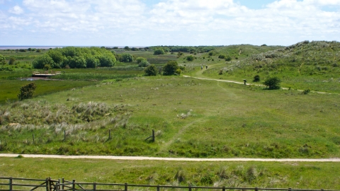
This important reserve contains tidal sand and mudflats, salt and freshwater marshes and sand dunes. On the foreshore, accreting mud and silt flats and saltmarsh in the north give way to a narrower sandy beach at the southern end. The sand dunes are also much wider in the north and there is an extensive freshwater marsh between two dune ridges, which converge into a narrower ridge south of Churchill Lane at Theddlethorpe. The much older landward dunes developed on a storm beach and are thought to have formed in the 7th to 8th centuries. The second ridge on the northern half of the reserve, enclosing the freshwater marsh, developed in the mid-1800s following the diversion of the Great Eau. New dunes are now forming along the southern half of the reserve.
Nearest postcode LN11 7TS. Please note - postcodes are for the nearest registered address as we are unable to get postcodes for nature reserves.
Location information
Saltfleetby-Theddlethorpe Dunes location


